
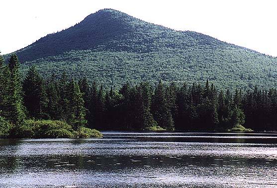
Cabot, the Bulge, and the Horn from Madison
Cabot - 4170'
(Jan/2006) Alert! The Mt Cabot Trail is closed due to a dispute between the WMNF and the land owner. The best way to hike to Mt Cabot is now the route from Mill Brook Road, using the Unknown Pond and Kilkenny Ridge Trails or the Bunnell Notch Trail from the Fish Hatchery. It's unknown when or if the trail will reopen.
Mt Cabot is the highest peak in the north country and the farthest north of NH's 4000 footers. The summit itself is completely wooded but just a few tenths away is an excellent view from the site of the old fire tower. The Cabot Cabin, maintained by the Jefferson Boy Scouts and the Pinkerton Academy Outing Club that sleeps eight is next to the site. Mt Waumbek is to the south along the Kilkenney Ridge trail.
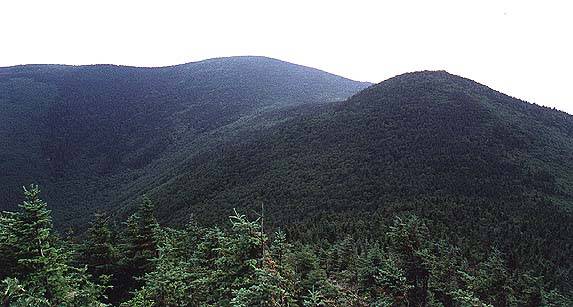
There are two smaller peaks to the north, The Horn and The Bulge which are both on the New England Hundred Highest lists. On the Mt Cabot trail coming in from the Fish Hatchery you can stop at Bunnell Rock, which is a short side trail away and has some nice views.
Routes
- Mt Cabot Trail - Closed. See note above.
- York Pond, Bunell Notch, Kilkenney Ridge, Mt Cabot - This somewhat complicated route is the shortest route and easiest to get to now that the Mt Cabot Trail is closed. Start past the Berlin Fish Hatchery on York Pond Road. There is a gate that is closed between 4:00 PM and 8:00 AM during the summer, call the Fish Hatchery at 603.449.3412 for details. Start on the York Pond trail and quickly turn left onto the Bunnell Notch trail. After about 3 miles turn right onto the Kilkenney Ridge trail and then shortly onto the Mt Cabot trail. Pass the Mt Cabot cabin about 1/2 mile before reaching the summit. Total distance is 9.6 miles and climbs roughly 2500'. Bunnell Notch has been known to be muddy at times, with some difficult route finding.
- Unknown Pond, Kilkenney Ridge trail - Start at the parking area on the Mill Brook road, reachable from Rt 110 in Stark NH. There is a gate less then a mile from the trailhead which is sometimes open. Follow the Unknown Pond trail to the pond, then climb the Kilkenney Ridge trail past the Horn and Bulge to the summit. Total distance is 6.1 miles and roughly 3100' elevation gain.
Trailheads
- Berlin Fish Hatchery - The York Pond Road (FR 13) leaves NH 110 7.4 miles from its juntion with Rt 16 north of Berlin. Stay on York Pond Road, down take the Bog Dam Road which intersects the road twice. The gate at the Fish Hatchery (2 miles from the trailhead) is closed from 4PM to 8AM. Contact the Fish Hatchery (603-449-3412) if you need to make arrangements for the gate to be left open. This trailhead serves the eastern end of both the Bunnell Notch and Unknown Pond trails.
- Mill Brook Road - Look for a hiker road sign about 5 miles east of Groveton on NH 110. Mill Brook Road (FR 11) goes 3.7 miles to a gate, usually closed except during hunting season, then .8 further to the trailhead. This trailhead serves the western end of the Unknown Pond trail.