Southern Presies Like They Ought to Be – Oct/20/1999
When you plan a weekend in the mountains during leaf season, you are at the whim of
the weather gods. Since we were locked into a weekend at a condo well ahead of time,
we didn’t know when peak leaf season would be, or if we’d get good weather for the
hike. As it turns out, we’d missed the peak by a little bit, but we hit the weather
dead on. We’d picked a hike in the southern Presidentials because it’s a great above
treeline hike in good weather, it makes for a nice pseudo-loop, and the last two
times I’d been there the views were non-existent.
 We drove directly to the Ammonoosuc trailhead, near the Cog RR base station, which
is where we expected to end up. You never can tell in the Presidentials. Then it
was back down the Mt Clinton Road to the Edmands Path trailhead. There were lots
of cars already there, so we had to park out on the road. Then we were on the
trail, which is a pretty flat at the bottom as we all got into the groove of the
hike. Soon though, we were climbing at a good pace. The Edmands Path is a very
well graded route, over 100 years old, and still one of the best ways to reach
treeline in the Presidentials. The higher we got, the more obvious it was that
we were going to have a good day .
We drove directly to the Ammonoosuc trailhead, near the Cog RR base station, which
is where we expected to end up. You never can tell in the Presidentials. Then it
was back down the Mt Clinton Road to the Edmands Path trailhead. There were lots
of cars already there, so we had to park out on the road. Then we were on the
trail, which is a pretty flat at the bottom as we all got into the groove of the
hike. Soon though, we were climbing at a good pace. The Edmands Path is a very
well graded route, over 100 years old, and still one of the best ways to reach
treeline in the Presidentials. The higher we got, the more obvious it was that
we were going to have a good day .

After passing a major steam crossing
where you have to step carefully across some wet rocks, you start getting views
of the northern peaks. After reaching the
proverbial warning sign and hitting
treeline, you hit the
trail junction with the Crawford Path on the backbone of the ridge. From here you
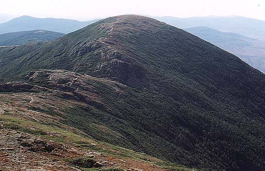
can see Mt Eisenhower, our first destination for the hike. The Mt Eisenhower
Loop goes past Red Lake, a small tarn at the col. The climb is steep but short
until you reach the broad open slopes of the summit, often considered to resemble
the mountain’s namesake. We spent some quality time up there,
communing with nature
and soaking up the slightly chilly sun. Bill and Geetha decided they
were going to hang out at the summit for a while longer to take in
the views then head back down
the same way. The rest of us were headed for Monroe.
 Travel on a ridge is different than other hiking. On a
clear day like this, time
loses meaning as you just walk and walk and walk. The views is all directions
are perfect, and after a short while you fail to notice the distance you travel
or the surrounding mountains. Instead you notice what’s
close by, a more intimate
view of the world. We could just walk, talk, and feel a part of the world at
Travel on a ridge is different than other hiking. On a
clear day like this, time
loses meaning as you just walk and walk and walk. The views is all directions
are perfect, and after a short while you fail to notice the distance you travel
or the surrounding mountains. Instead you notice what’s
close by, a more intimate
view of the world. We could just walk, talk, and feel a part of the world at
 large. As we cruised along northward, I wanted to make sure we stopped by the
summit of
Mt Franklin, a small bump on the ridge with some great views into
Oakes Gulf and the Dry River. It’s also just a bit off the beaten path, which
helps get some perspective on the path you’ve been traveling. Then it was back
to the Crawford Path and up the
south peak of Monroe. This section of trail is
fairly rough and uneven, and unless you are careful you can loose the trail. We
also found a strange little man, but he seemed harmless enough.
large. As we cruised along northward, I wanted to make sure we stopped by the
summit of
Mt Franklin, a small bump on the ridge with some great views into
Oakes Gulf and the Dry River. It’s also just a bit off the beaten path, which
helps get some perspective on the path you’ve been traveling. Then it was back
to the Crawford Path and up the
south peak of Monroe. This section of trail is
fairly rough and uneven, and unless you are careful you can loose the trail. We
also found a strange little man, but he seemed harmless enough.
 We hung out on the summit of Monroe, just above the Crawford
Path, knowing that it was the
high point of the
trip, and we were about to embark on a long descent. We'd spent several hours above
treeline on one of the most wonderful hiking days of the fall, and now we were going
We hung out on the summit of Monroe, just above the Crawford
Path, knowing that it was the
high point of the
trip, and we were about to embark on a long descent. We'd spent several hours above
treeline on one of the most wonderful hiking days of the fall, and now we were going
 to drop several thousand feet in a few miles, so the rest was in order. We
dropped
down towards Lakes of the Clouds, but we didn't
hang around very long at the hut. Then,
down and down and down the Ammy waving to the Smog Railroad as
we hiked. We took the short sidetrip to the gorge and its
wonderful waterfall,
then finally made it out to the cars. One half the group continues
to the cog base station where the rest of us, who hike to the parking area, picked
them up. Then back to the car at the Edmands Path trailhead, and off to a well
deserved meal back home.
to drop several thousand feet in a few miles, so the rest was in order. We
dropped
down towards Lakes of the Clouds, but we didn't
hang around very long at the hut. Then,
down and down and down the Ammy waving to the Smog Railroad as
we hiked. We took the short sidetrip to the gorge and its
wonderful waterfall,
then finally made it out to the cars. One half the group continues
to the cog base station where the rest of us, who hike to the parking area, picked
them up. Then back to the car at the Edmands Path trailhead, and off to a well
deserved meal back home.
Back to White Mountains home page