Mt Eisenhower via the Edmands Path - 26/Jul/98
 It looked like it was going to be a nice day and I was already up north, so I
chose to hike up Eisenhower. I wanted to get above treeline and the Edmands
Path is a quick shot up. So, leaving Hanover early in the morning I hit the
trailhead off the Mt Clinton Road by 9:00. The bottom section of the trail is
a nice walk through the woods, crossing streams and climbing slowly but surely.
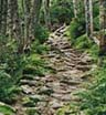
After about 1.5 miles, you I started climbing more steeply. In this section
of trail you can see some of the excellent rockwork that
has kept this trail a favorite for over 100 years. As I approached treeline,
there were views to the north where the weather didn't
look as good as I'd hoped. At least it wasn't raining.
It looked like it was going to be a nice day and I was already up north, so I
chose to hike up Eisenhower. I wanted to get above treeline and the Edmands
Path is a quick shot up. So, leaving Hanover early in the morning I hit the
trailhead off the Mt Clinton Road by 9:00. The bottom section of the trail is
a nice walk through the woods, crossing streams and climbing slowly but surely.
After about 1.5 miles, you I started climbing more steeply. In this section
of trail you can see some of the excellent rockwork that
has kept this trail a favorite for over 100 years. As I approached treeline,
there were views to the north where the weather didn't
look as good as I'd hoped. At least it wasn't raining.
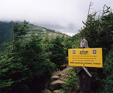
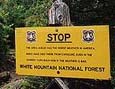 I reached one of those famous signs that warns hikers
as they leave the shelter of the trees. Then I was at
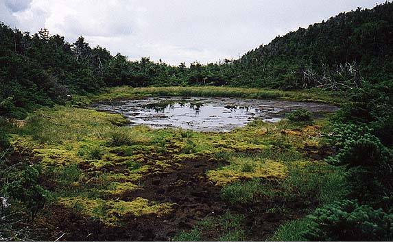
the intersection with the Crawford Path, on the ridge. Just off the trail is
Red Pond, a small murky lake that can provide water for
the very thirsty. It's a good place to stop and rest, and several folks were
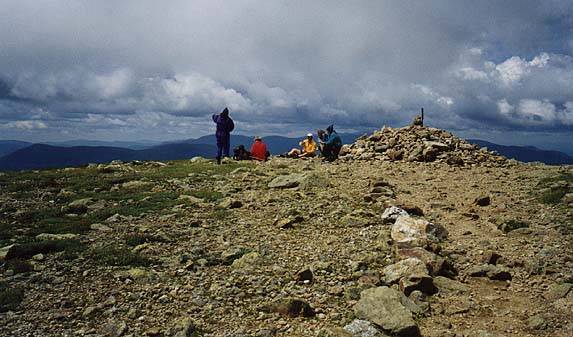
grabbing a snack and resting. I pushed on to the summit
which was partly clear and had a few people. I rested and put on my wind shell
and after a few minutes I had the summit to myself, alone in the clouds. For
nearly 30 minutes, my world was reduced to a circle of maybe 200 feet, with
undifferentiated white all around. Occasionally, the wail of the
Cog Railroad pierced the fog, but for all I knew
the world off this lonely mountain peak could have disappeared. It was a
rare and wonderful feeling, being this alone on a Presidential summit in the
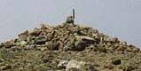
middle of a summer weekend. I sat on the summit cairn and thought how lucky
I was to have this experience.
I reached one of those famous signs that warns hikers
as they leave the shelter of the trees. Then I was at
the intersection with the Crawford Path, on the ridge. Just off the trail is
Red Pond, a small murky lake that can provide water for
the very thirsty. It's a good place to stop and rest, and several folks were
grabbing a snack and resting. I pushed on to the summit
which was partly clear and had a few people. I rested and put on my wind shell
and after a few minutes I had the summit to myself, alone in the clouds. For
nearly 30 minutes, my world was reduced to a circle of maybe 200 feet, with
undifferentiated white all around. Occasionally, the wail of the
Cog Railroad pierced the fog, but for all I knew
the world off this lonely mountain peak could have disappeared. It was a
rare and wonderful feeling, being this alone on a Presidential summit in the
middle of a summer weekend. I sat on the summit cairn and thought how lucky
I was to have this experience.
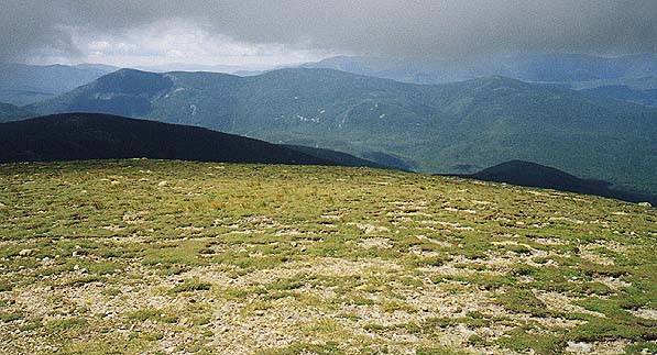
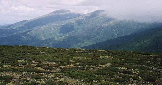
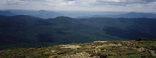
 Eventually the sun came through and the world reasserted itself. I was still
alone, but I could now see Tom, Field and Willey to the
south, as well as Jackson and Clinton.
The northern Presidentials never really cleared so I was
glad I hadn't chosen a trip up Washington. Soon, another
group arrived. One of the first things one of them did was pull out a GPS
unit and declare that they were 17.5 miles from the summit of Hedgehog Mountain
where they had hiked yesterday. At that moment in my life, it seemed like a
particularly unimportant piece of information. Nothing against GPS, but everyone
knew exactly where we were. I looked across to
Montalben Ridge and thought about how I'd only been up there once, hiking
my last 4000'er, in the fog. Next time I wanted a clear day.
Eventually the sun came through and the world reasserted itself. I was still
alone, but I could now see Tom, Field and Willey to the
south, as well as Jackson and Clinton.
The northern Presidentials never really cleared so I was
glad I hadn't chosen a trip up Washington. Soon, another
group arrived. One of the first things one of them did was pull out a GPS
unit and declare that they were 17.5 miles from the summit of Hedgehog Mountain
where they had hiked yesterday. At that moment in my life, it seemed like a
particularly unimportant piece of information. Nothing against GPS, but everyone
knew exactly where we were. I looked across to
Montalben Ridge and thought about how I'd only been up there once, hiking
my last 4000'er, in the fog. Next time I wanted a clear day.
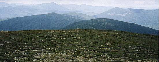
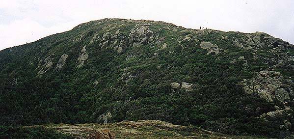
 Soon I decided it was time to head back down to the
Crawford Path. The clouds had been rising since the sun had come out and I
could finally see the summit of Monroe. I dropped back down and took a little
time to expore the area around the trail junction, keeping sure to only walk on
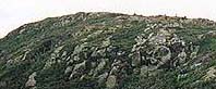
the solid rock and not step on any alpine vegitation. From the rocks I got a
nice view of the Eisenhower summit. After a Powerbar I
headed back down the Edmands Path, passing lots of tired and unhappy climbers
headed for Lakes of the Clouds. They were not very pleased to find out that
they were only half way to the ridge, still quite a ways from the hut and their
beds for the night. I also noticed some interesting
trailwork . It looked like sections of logs were buried in the trail, end
down, to make a postpile walkway. I've never seen this before in my many years
of trailwork, but it looked like it'd work. By 1:00 I was in my car and headed
home, after recharging my batteries with a hike above treeline.
Soon I decided it was time to head back down to the
Crawford Path. The clouds had been rising since the sun had come out and I
could finally see the summit of Monroe. I dropped back down and took a little
time to expore the area around the trail junction, keeping sure to only walk on
the solid rock and not step on any alpine vegitation. From the rocks I got a
nice view of the Eisenhower summit. After a Powerbar I
headed back down the Edmands Path, passing lots of tired and unhappy climbers
headed for Lakes of the Clouds. They were not very pleased to find out that
they were only half way to the ridge, still quite a ways from the hut and their
beds for the night. I also noticed some interesting
trailwork . It looked like sections of logs were buried in the trail, end
down, to make a postpile walkway. I've never seen this before in my many years
of trailwork, but it looked like it'd work. By 1:00 I was in my car and headed
home, after recharging my batteries with a hike above treeline.
The trailhead for the Edmands Path is about two miles up the Mt Clinton Road
from Crawford Notch, or 1 mile from the Marshfield Road. The parking lot is
large but can fill up on summer weekends, forcing people to park on the side
of the road. The lot does require a WMNF parking pass and the road is closed
in the winter. The trailhead is at 2036', making for a climb of 2725', the last
350' above treeline. It's 3 miles to the Mt Eisenhower Loop which takes you
the final .4 miles to the bald, exposed summit. There are several stream crossings
on the way up to get water. If you stash a car at Crawford Notch you can mike
a nice loop with the Crawford Path, hitting Mt Pierce (Clinton) and Mizpah
Springs Hut.
Back to White Mountains home page