This dayhike was one where it was just time to head up to the mountains. We were looking for something relatively close to Boston, and Mt Libery, at the southern end of Franconia Notch, fits the bill nicely. It's a pretty straight-forward hike, up and back the same trail with a wonderful view at the top. We (me, Ching, Andrew, Susan, and Vivien) piled into the Volvo like the good little yuppies we are and headed north. With a good tailwind and a heavy foot it's only a bit more than two hours to the trailhead. We parked, put on our boots, and headed up the trail that runs parallel to Franconia Notch bikepath until it reaches the true trailhead for the Liberty Springs trail in about a mile.
The bottom of the trail is steady up, slabbing first left than right as we climbed up through the hardwoods. After the junction with the Flume Slide trail (very steep and often wet) we cross the one significant stream crossing and begin climbing in earnest. Since we are of varying speeds, we spread out a bit in this section, until reaching the Liberty Springs Campsite. We'd seen many large groups heading down, and the caretaker at the campsite said there were 60 people up there on Saturday night, plus a bunch more in the quasi-legal spots on the ridge! Very busy on Saturday nights up there.
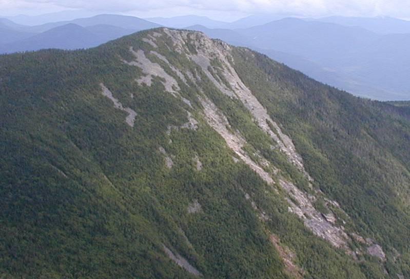
We stopped there for lunch, next to the spring that gives the place its name and its value as a campsite. Both Sue and Vivien were a little iffy about continuing on to the summit but we convinced them that although the next section was a little steep, it was short and the views were extremely worth it. It's only .3 to the ridge, then up through the steadily shortening trees to the summit, poking out of the trees. It really was a wonderful day with views all around the Pemi and a bit beyond. Lincoln (you can't really see Lafayette from the summit) was in and out of the clouds, so we were happy with our choice of hikes. Sue and Vivien headed down after a snack and some water, hoping to take it slowly and preserve their knees. Ching, Andrew, and I spend quite a bit of time up there. While hanging around, two National Guard A-10 planes came swooping through the Pemi, up past Garfield and looped around south again, to the west of Cannon. A very impressive sight! We were slightly tempted to run over to Flume but calmer heads prevailed and we were satisfied with all the views.
I was using a digital camera (Olympus C-2020) on this trip, trying to decide what model I will buy when I finally take the plunge. This camera has a Quicktime video mode, so I took a panoramic view of the Pemi. Hopefully this will be a common feature on future trip reports. As always on trips like this, the journey down was fast and uneventful. We caught up to the other two and spend the journey down talking about stuff and just enjoying the heck out of nature. The last mile, from where you come out on the bikepath to the parking lot is way too long, but we made it without anything bad happening. A stop at the Common Man in Ashland for dinner completed the journey.