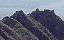
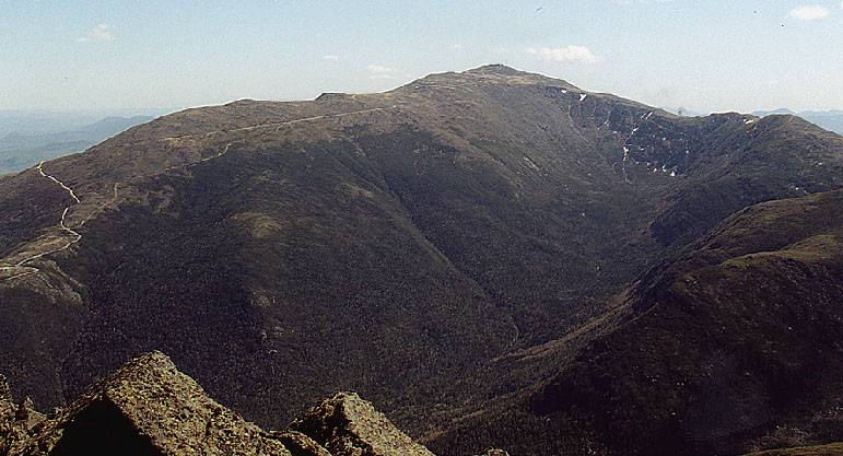
King Ravine, Adams and Edmands Col
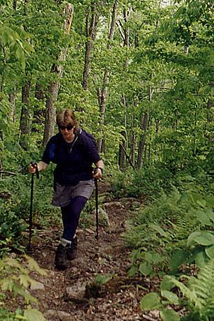
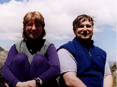
 Brenda and I were staying in Jefferson at the
Applewood B&B for the weekend and the
forecast for Saturday was spectacular. We were looking for a fantastic above treeline
trip, and King Ravine was first on our list. After a lovely pancake breakfast we headed
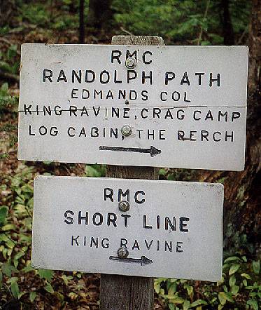
to Appalachia to start the hike. To get to King Ravine, we took
Airline, to Short Line,
to King Ravine trail; in the northern Presies,
trail junctions seem to come every
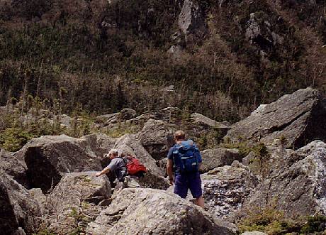
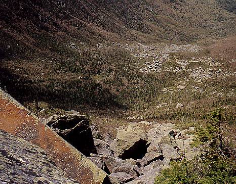
100 yards. After Mossy Falls, the trail climbs up onto the
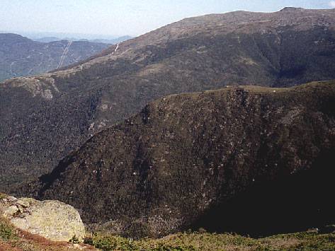
floor of the ravine. If
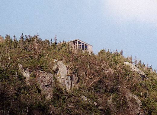
you've never been there, the floor of King Ravine is a
jumble of huge boulders, surrounded
on three sides by steep walls that rise
over 1000 feet, with
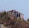
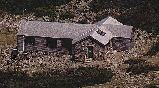
Crag Camp way above us. After I took a huge quanitity
of pictures and we grabbed our first
rest of the day, it was time for the fun to begin.
Brenda and I were staying in Jefferson at the
Applewood B&B for the weekend and the
forecast for Saturday was spectacular. We were looking for a fantastic above treeline
trip, and King Ravine was first on our list. After a lovely pancake breakfast we headed
to Appalachia to start the hike. To get to King Ravine, we took
Airline, to Short Line,
to King Ravine trail; in the northern Presies,
trail junctions seem to come every
100 yards. After Mossy Falls, the trail climbs up onto the
floor of the ravine. If
you've never been there, the floor of King Ravine is a
jumble of huge boulders, surrounded
on three sides by steep walls that rise
over 1000 feet, with
Crag Camp way above us. After I took a huge quanitity
of pictures and we grabbed our first
rest of the day, it was time for the fun to begin.
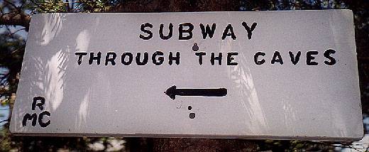
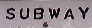 From the entrance to the ravine, you have two choices to get to the King Ravine Headwall.
You can take the Elevated, which is the easier trail, or the
Subway, which climbs over,
under, and
through the jumble of boulders that I mentioned in the previous paragraph.
Guess which one we chose? At one point, I had to take off my pack, toss it down to
Brenda, then lower myself blindly to the floor of a small cave. After the Subway and
the Elevated rejoin, you get yet another side path option, the Ice Caves Loop. Guess
which one we chose? Here is more climbing and scrambling, with the added bonus of
ice and snow
that can last through the year. When we were done with
all that fun, it was
time to start the real climbing.
From the entrance to the ravine, you have two choices to get to the King Ravine Headwall.
You can take the Elevated, which is the easier trail, or the
Subway, which climbs over,
under, and
through the jumble of boulders that I mentioned in the previous paragraph.
Guess which one we chose? At one point, I had to take off my pack, toss it down to
Brenda, then lower myself blindly to the floor of a small cave. After the Subway and
the Elevated rejoin, you get yet another side path option, the Ice Caves Loop. Guess
which one we chose? Here is more climbing and scrambling, with the added bonus of
ice and snow
that can last through the year. When we were done with
all that fun, it was
time to start the real climbing.
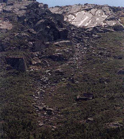
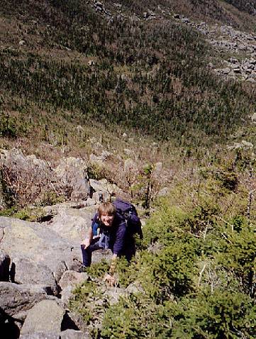
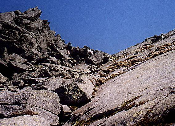
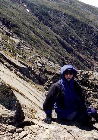
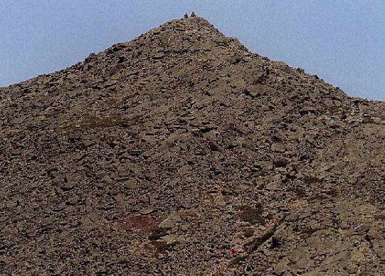
 The headwall of the King Ravine Trail climbs 1100' in half a mile. This is steep and
unrelenting. The footing is OK, but there is some loose stuff underfoot. We were
working hard and fairly protected from the wind as we climbed, but as the ravine
spread out below us we could sense a chill in the air. From
below you see the Gateway
where the trail exits the ravine and joins up with the Airline. When
we crested the
climb we were hit with
some wind and as we stopped to rest and eat, we cooled off
very quickly. But the views from here were spectacular, as we could now see over
towards Jefferson and Madison, back across King Ravine,
everywhere was clear and gorgeous. It's well worth the effort,
but our hike wasn't close to being done.
The headwall of the King Ravine Trail climbs 1100' in half a mile. This is steep and
unrelenting. The footing is OK, but there is some loose stuff underfoot. We were
working hard and fairly protected from the wind as we climbed, but as the ravine
spread out below us we could sense a chill in the air. From
below you see the Gateway
where the trail exits the ravine and joins up with the Airline. When
we crested the
climb we were hit with
some wind and as we stopped to rest and eat, we cooled off
very quickly. But the views from here were spectacular, as we could now see over
towards Jefferson and Madison, back across King Ravine,
everywhere was clear and gorgeous. It's well worth the effort,
but our hike wasn't close to being done.
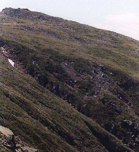
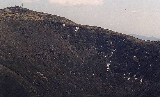
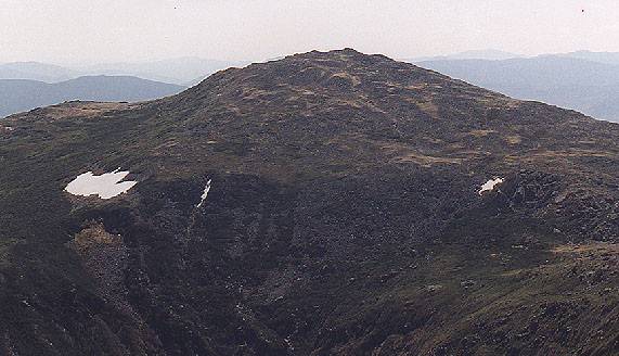
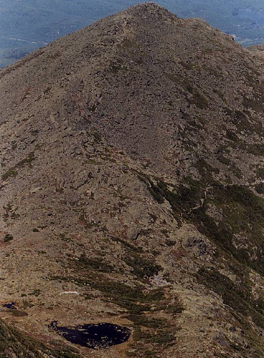
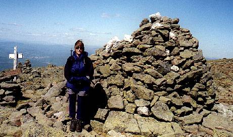
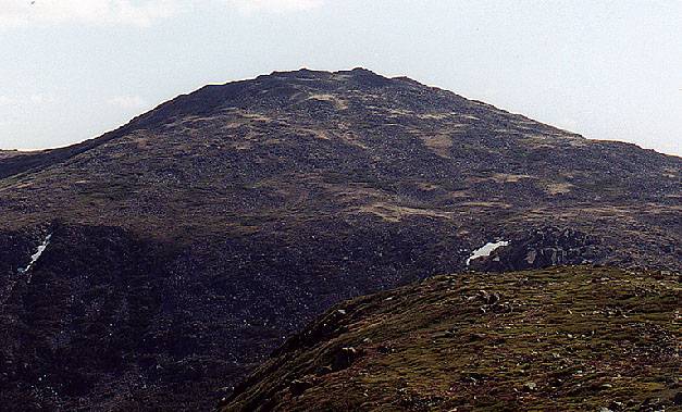
 The trail junction is just above Madison Hut, and gives an
excellent view of Madison
summit. The whole upper mountain is just a big pile of rocks.
So is Adams, which was
our immediate destination. We followed the airline, higher and higher, rockier and
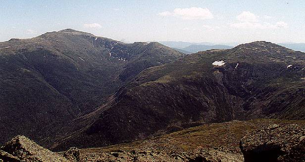
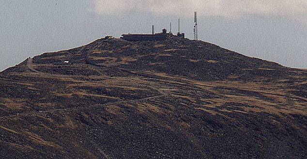
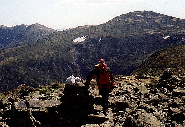
rockier. Eventually we topped out on the summit, and got our first views of the rest
of the world. Washington and the
Great Gulf, Jefferson, Clay, and
Madison just loom in front of you, seemingly just
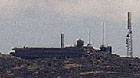
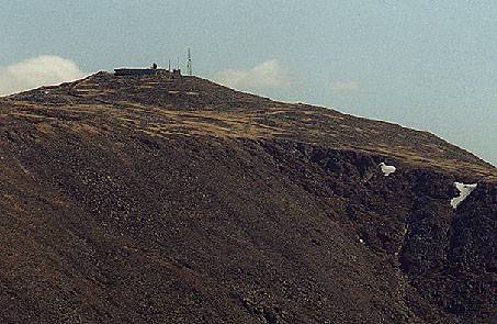
out of reach. With my new 100-300mm telephoto lens we could easily make out
the Washington summit buildings and cars on the
Auto Road and hear and see the Cog RR.
It was time for lunch. After eating and taking lots and
lots of pictures, we started
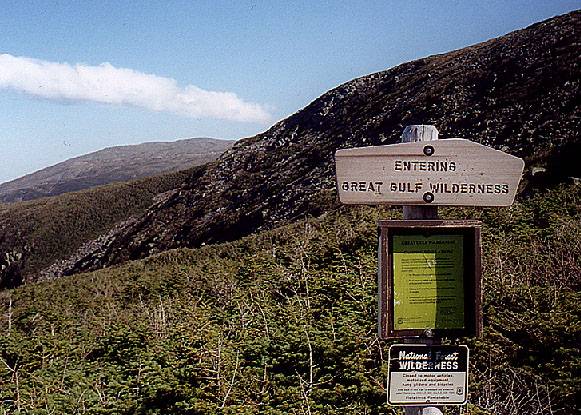
planning our decent. The original plan was to go down via Lowe's Path, visit the RMC
huts, and drop down from there, but the weather was so nice that we decided to stay
above treeline for a bit longer. We changed our route to head over to Edmands Col
via the Gulfside trail, then return to Appalachia on the Randolph Path. Unfortunately,
my time estimations were a bit off. More on that later.
The trail junction is just above Madison Hut, and gives an
excellent view of Madison
summit. The whole upper mountain is just a big pile of rocks.
So is Adams, which was
our immediate destination. We followed the airline, higher and higher, rockier and
rockier. Eventually we topped out on the summit, and got our first views of the rest
of the world. Washington and the
Great Gulf, Jefferson, Clay, and
Madison just loom in front of you, seemingly just
out of reach. With my new 100-300mm telephoto lens we could easily make out
the Washington summit buildings and cars on the
Auto Road and hear and see the Cog RR.
It was time for lunch. After eating and taking lots and
lots of pictures, we started
planning our decent. The original plan was to go down via Lowe's Path, visit the RMC
huts, and drop down from there, but the weather was so nice that we decided to stay
above treeline for a bit longer. We changed our route to head over to Edmands Col
via the Gulfside trail, then return to Appalachia on the Randolph Path. Unfortunately,
my time estimations were a bit off. More on that later.
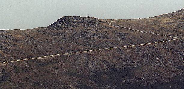
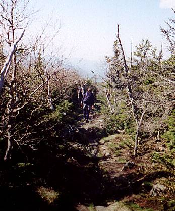
 As we dropped down to Tunderstorm junction and headed across to
Edmands, we only saw a very few people. It was getting on
late in the afternoon and we had the place almost
to ourselves. It's extremely peaceful
up top with no distractions to take away from
the view. When we got to the Col
we passed a few people going
in the opposite direction, we hoped they had headlamps. The Col was about as
windfree
as I'd ever seen it. By now we figured out that we were going to get out around dark.
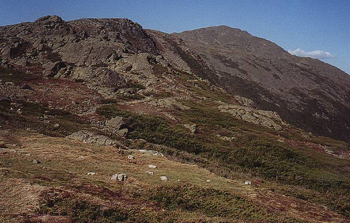
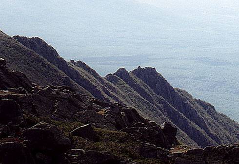
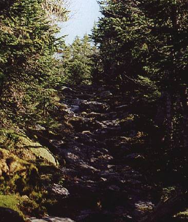
The top part of the Randolph Path is rough, as we stayed on the contour, but you are
payed off by the views of the
Castilated Ridge. After a few trail junctions the trail
starts dropping, steadily and
unrelentingly. It took us over 2 and a half hours to
make it from Edmands Col to the trailhead, getting out just after 8:00. We had planned
to go back to Jefferson, shower and change before dinner, but instead we drove to
Gorham, stopped at an Italian restraurant for a big pasta meal, then back to the B&B
where we took advantage of the hot tub on the porch of our room.
As we dropped down to Tunderstorm junction and headed across to
Edmands, we only saw a very few people. It was getting on
late in the afternoon and we had the place almost
to ourselves. It's extremely peaceful
up top with no distractions to take away from
the view. When we got to the Col
we passed a few people going
in the opposite direction, we hoped they had headlamps. The Col was about as
windfree
as I'd ever seen it. By now we figured out that we were going to get out around dark.
The top part of the Randolph Path is rough, as we stayed on the contour, but you are
payed off by the views of the
Castilated Ridge. After a few trail junctions the trail
starts dropping, steadily and
unrelentingly. It took us over 2 and a half hours to
make it from Edmands Col to the trailhead, getting out just after 8:00. We had planned
to go back to Jefferson, shower and change before dinner, but instead we drove to
Gorham, stopped at an Italian restraurant for a big pasta meal, then back to the B&B
where we took advantage of the hot tub on the porch of our room.
Back to White Mountains home page