Garfield and Galehead Trip - 31/Jun/98
This trip was not so much designed, as happened. Brenda and I were
feeling the need for a hike to get started on the summer hiking season
and just as I was about to send mail asking friends if they wanted to
come along, I get two messages about people looking for hiking partners.
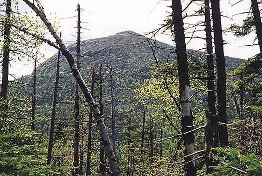
Ain't the internet grand? We settled on my original choice, Garfield,
because the peakbaggers in the group hadn't gotten it yet and
we all wanted to be somewhere with views on a day with such great weather.
 We left from Nashua around 8:00 and were at the trailhead before 10:00,
which is a great start for this crowd. The trailhead parking was a
little crowded but we found some spots and off we went. The Garfield
trail is better than I remembered, very evenly graded for most of it's
4.4 mile length. There's not much in the way of views, but the sunny
and cool weather made for fast and pleasant hiking. We hit the
Garfield Ridge trail junction in about 2 hours, and climbed the steep
but short section to the summit. There were only two people there
when we arrived and they left soon after.
We left from Nashua around 8:00 and were at the trailhead before 10:00,
which is a great start for this crowd. The trailhead parking was a
little crowded but we found some spots and off we went. The Garfield
trail is better than I remembered, very evenly graded for most of it's
4.4 mile length. There's not much in the way of views, but the sunny
and cool weather made for fast and pleasant hiking. We hit the
Garfield Ridge trail junction in about 2 hours, and climbed the steep
but short section to the summit. There were only two people there
when we arrived and they left soon after.
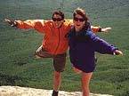
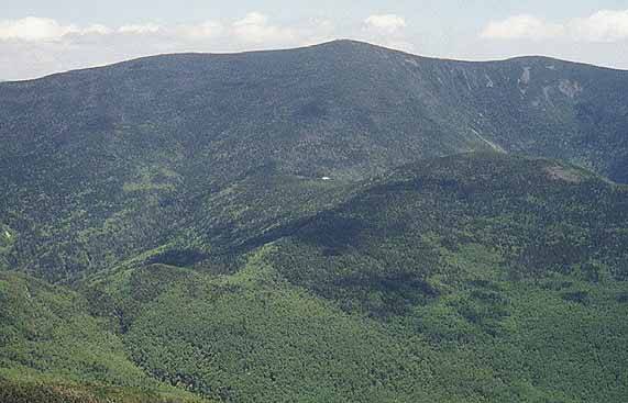
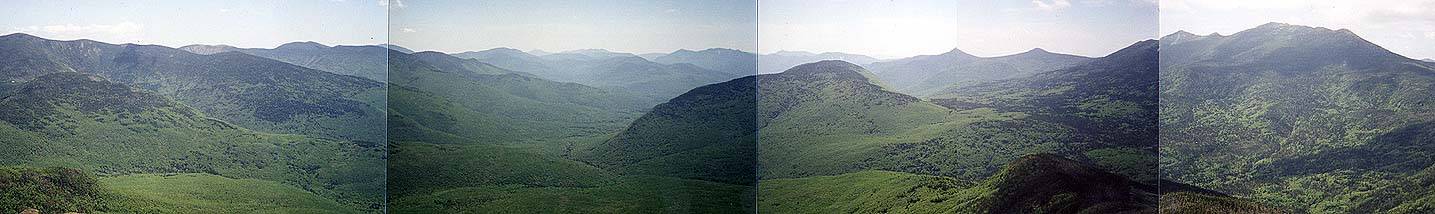
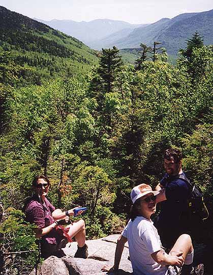
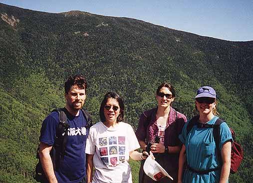
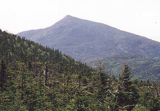
The views from Garfield are some of the best in the Pemi. Only the
Bonds offer a better view IMO. We could see the entire Pemi: North and
South Twin, Galehead Hut, Franconia Ridge,
and a full Pemi panoramic . The Presidentials
were in clouds, but that was about it for the day. The
summit of Garfield has some bare rock with the concrete foundation
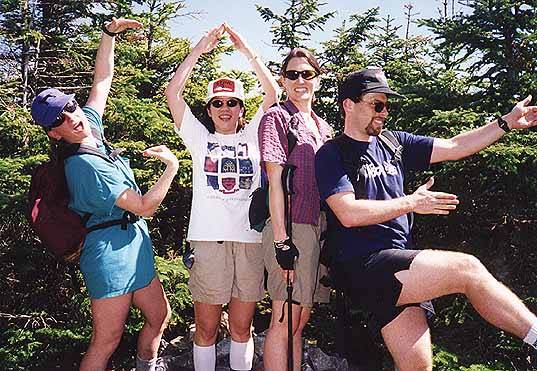
of an old firetower. It was quite windy, so we put on jackets and
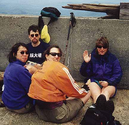
looked around for a while, before settling down in the foundation for
a bite to eat. Here we developed a plan to hike the ridge over to
Galehead to bag another 4000'er. If I had know they were up for it
I would have suggested stashing a car at the other trailhead, but it
was only a 1.6 mile road walk and we decided to go for it.
 From the summit, the trail drops rapidly to the ridge, passing the
Garfield Ridge Campsite along the way. It's rocky and wet it places,
making for slow going. After the Campsite, the trail obviously gets
less use, and there were many uncleared blowdowns from the winter.
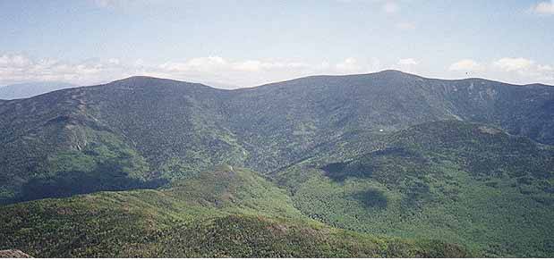
It's about 3.5 miles from the summit of Garfield to Galehead hut. Along
the way there are a few very nice views back to Garfield, over to
Galehead and the Twins, and down into the Pemi.
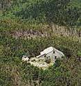
We made it to the hut
and decided to grab the peak, then eat lunch. The Frost trail leads
from the hut to the summit, passing a nice outlook
along the way. The
summit of Galehead is wooded with no views, so we had to make due
with what we had.
From the summit, the trail drops rapidly to the ridge, passing the
Garfield Ridge Campsite along the way. It's rocky and wet it places,
making for slow going. After the Campsite, the trail obviously gets
less use, and there were many uncleared blowdowns from the winter.
It's about 3.5 miles from the summit of Garfield to Galehead hut. Along
the way there are a few very nice views back to Garfield, over to
Galehead and the Twins, and down into the Pemi.
We made it to the hut
and decided to grab the peak, then eat lunch. The Frost trail leads
from the hut to the summit, passing a nice outlook
along the way. The
summit of Galehead is wooded with no views, so we had to make due
with what we had.
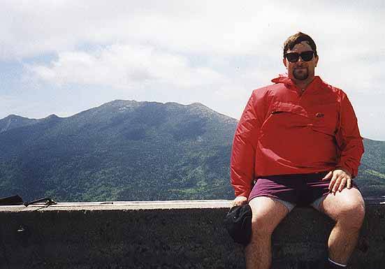
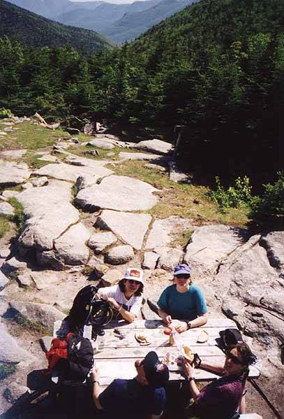
 Back at the hut we ate lunch on the picnic table outside and took
in the views of Garfield and Galehead, then got ready
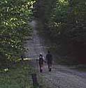
for the descent down the Gale River trail. It's about 4.5 miles and
the top part is steep with lots of excellent rock steps. Allison was
game to go ahead, so we gave her my car keys and she agreed to do the
road walk and get the car. The bottom part of the trail is much longer
than it appears, travelling along the Gale River and by the time we hit the trailhead and started the
roadwalk, we were beat. Fortunately, Alisson showed up soon after we
started walking. Ching and Andrew headed north and the rest of us
went to the Common Man in Ashland for a fine dinner before heading home. The peak bagging
continues, semper fi.
Back at the hut we ate lunch on the picnic table outside and took
in the views of Garfield and Galehead, then got ready
for the descent down the Gale River trail. It's about 4.5 miles and
the top part is steep with lots of excellent rock steps. Allison was
game to go ahead, so we gave her my car keys and she agreed to do the
road walk and get the car. The bottom part of the trail is much longer
than it appears, travelling along the Gale River and by the time we hit the trailhead and started the
roadwalk, we were beat. Fortunately, Alisson showed up soon after we
started walking. Ching and Andrew headed north and the rest of us
went to the Common Man in Ashland for a fine dinner before heading home. The peak bagging
continues, semper fi.
The Galehead trailhead is located on the Gale River Loop (FR 92), just off
NH Rt 3. The loop leaves just .3 miles south of Five Corners, and the trailhead
is 1.2 miles in, on the right. To get to the Gale River trailhead, continue
on the Gale River Loop for 1.6 miles or take the other end of loop where it
hits Rt 3. The hike is 14 miles and there are two sure places to get water
along the way: Garfield Ridge Campsite
and Galehead Hut. In the winter, the hut
is closed and the roads are gated, so this loop is really only a summer day
hike.
Back to White Mountains home page