I've always wanted to hike the Huntington Ravine trail, which is always referred to as the hardest hiking trail in the White Mountains. In addition, the Alpine Garden trail was in bloom, a once a year occurrence that I'd also never experienced in my many years of hiking here. Brenda was in the same boat, and we were excited by the prospect of knocking off two trails from our list of things-to-do. The previous day we drove up to Tripoli Road and hiked up Osceola with some friends from Boston. We figured that we would be a good warm up without exhausting us for the next day's much bigger hike. We grabbed a room in a Swiss alpine-style hotel in Intervale, springing for a hot tub room, which was kind of a waste since it was so hot out. A fine dinner at the Red Parka (excellent Prime Rib) and we got a good night's sleep.
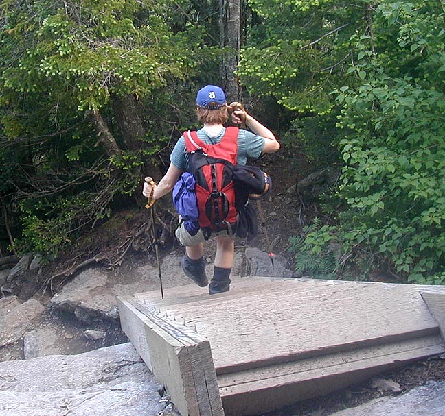
 We woke up early and headed to Pinkham Notch to grab some breakfast before heading out. We got
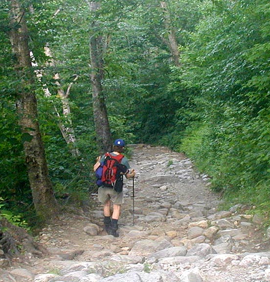
on the trail pretty early, which was a good thing. It was hot and humid, and we were carrying 3
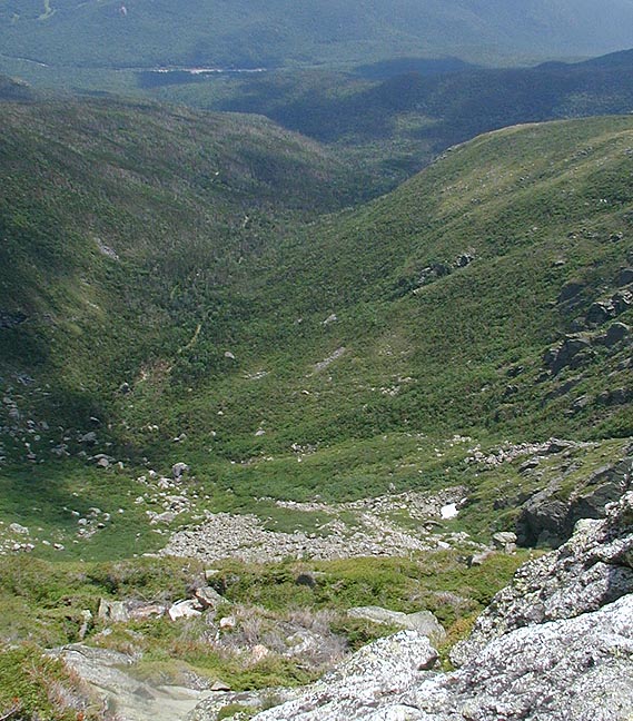
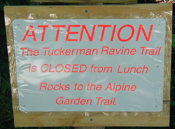
liters of water each. The bottom of the hike is up the Tuckerman Ravine trail, which was still closed
up the headwall, and we met a group
of Boy Scouts who were headed over Washington and Clay, then down the Sphinx trail to camp. It
like they were in for a long day, especially at the speed they were going. Then we
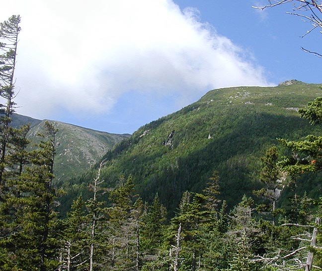
branched off on the Huntington Ravine trail. It was nice getting off the tractor road, and
there's more shade and cool water here, plus some
tantalizing views of the ravines above.
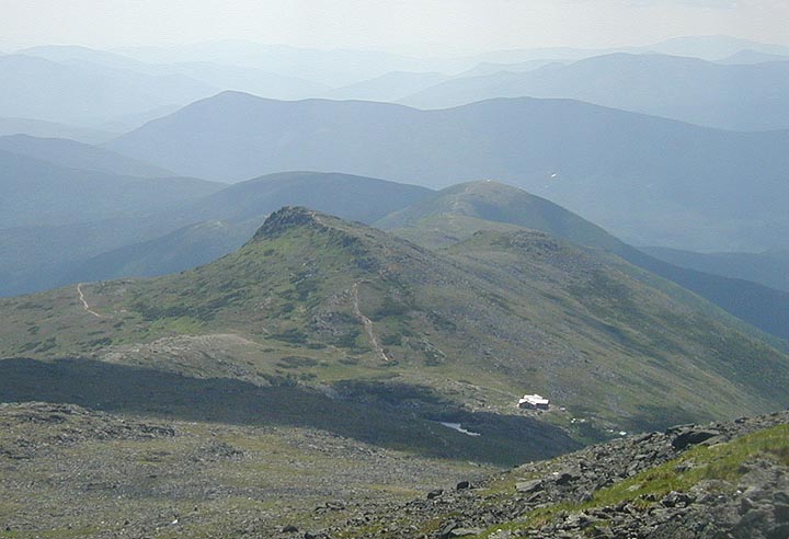
After a while, we came out on the Huntington fire road, and dropped down to check out the
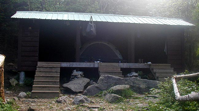
Harvard Cabin, now closed for the season. Back up to the Huntington Ravine trail as we got
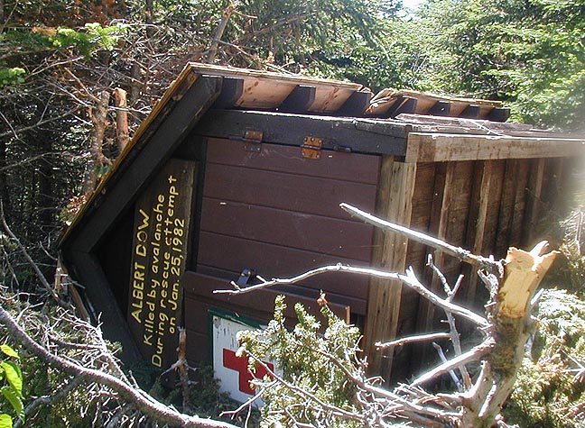
closer and closer to the headwall. Along the way we passed the Albert Dow Memorial safety
cache, which had been knocked off it's stand and pushed 100 yards down ravine by an
avalanche
that winter. It's pretty amazing thinking about the force needed to do that. But we could now
see where we were going.
We woke up early and headed to Pinkham Notch to grab some breakfast before heading out. We got
on the trail pretty early, which was a good thing. It was hot and humid, and we were carrying 3
liters of water each. The bottom of the hike is up the Tuckerman Ravine trail, which was still closed
up the headwall, and we met a group
of Boy Scouts who were headed over Washington and Clay, then down the Sphinx trail to camp. It
like they were in for a long day, especially at the speed they were going. Then we
branched off on the Huntington Ravine trail. It was nice getting off the tractor road, and
there's more shade and cool water here, plus some
tantalizing views of the ravines above.
After a while, we came out on the Huntington fire road, and dropped down to check out the
Harvard Cabin, now closed for the season. Back up to the Huntington Ravine trail as we got
closer and closer to the headwall. Along the way we passed the Albert Dow Memorial safety
cache, which had been knocked off it's stand and pushed 100 yards down ravine by an
avalanche
that winter. It's pretty amazing thinking about the force needed to do that. But we could now
see where we were going.
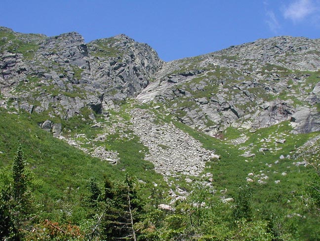
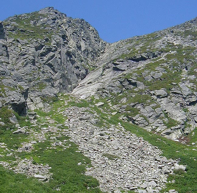
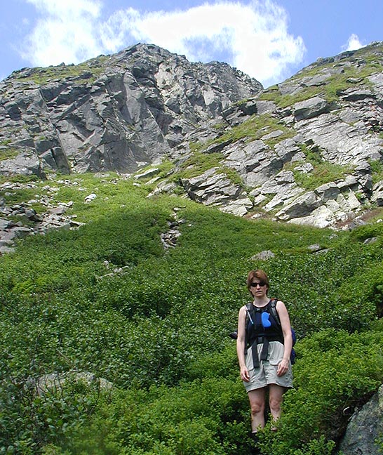
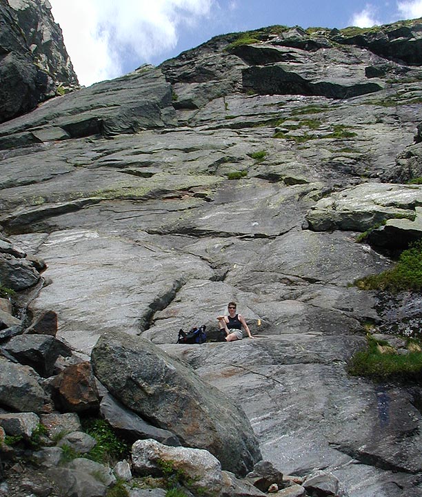
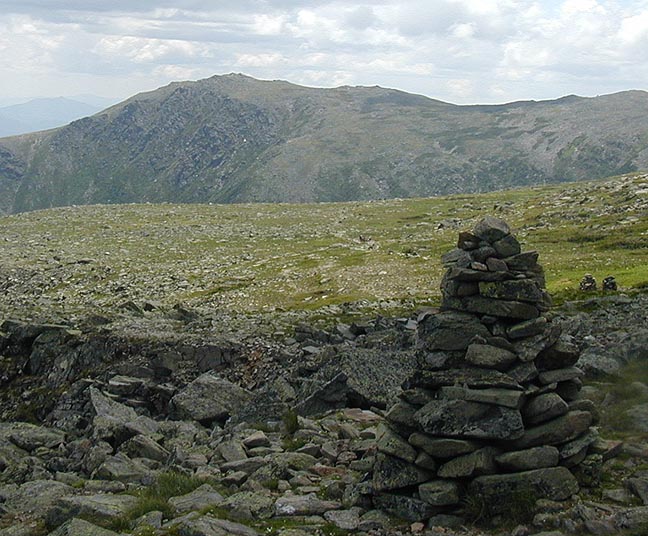
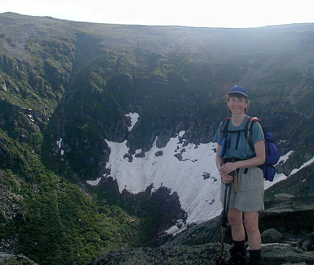
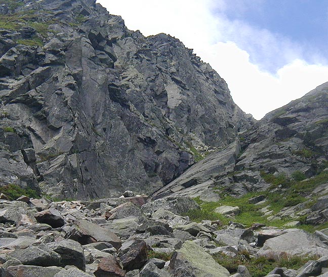 Gradually, we worked our way up to the Fan, the
large sloping talus slope of rock that has
fallen down from the ravine headwall. On our way up, over, and through the rocks we found
some patches of snow still holding on in the
nooks and crannies. I took some snow and put
it in my hat to help cool me off. It was hot in the solar oven of the ravine, and we were
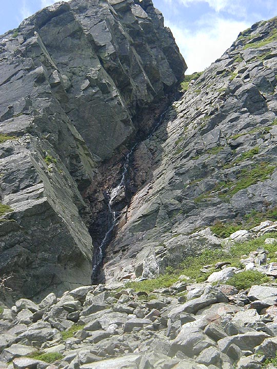
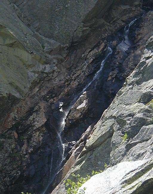
going through water at a pretty good pace. You can see up into the gullies of Huntington,
where in winter the ice climbers play. It was hard to imagine the snow, being so hot as
it was, but the streams ran cold and I drank some. Very refreshing. Above us we could see
and hear some other hikers, who'd made it up and over the difficult sections of the headwall,
so we could make out where the route went. It looked rather steep, but we were confident
that we'd make it.
Gradually, we worked our way up to the Fan, the
large sloping talus slope of rock that has
fallen down from the ravine headwall. On our way up, over, and through the rocks we found
some patches of snow still holding on in the
nooks and crannies. I took some snow and put
it in my hat to help cool me off. It was hot in the solar oven of the ravine, and we were
going through water at a pretty good pace. You can see up into the gullies of Huntington,
where in winter the ice climbers play. It was hard to imagine the snow, being so hot as
it was, but the streams ran cold and I drank some. Very refreshing. Above us we could see
and hear some other hikers, who'd made it up and over the difficult sections of the headwall,
so we could make out where the route went. It looked rather steep, but we were confident
that we'd make it.
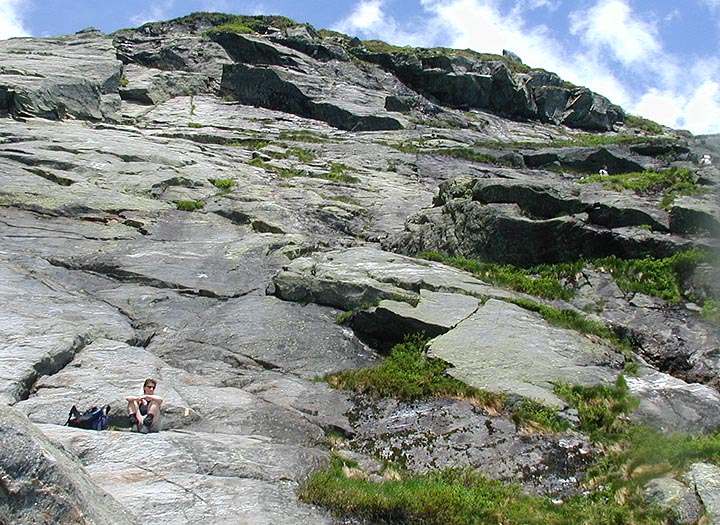
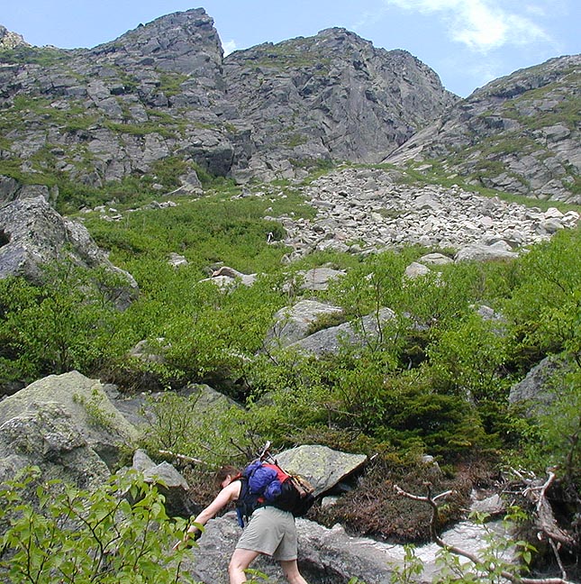
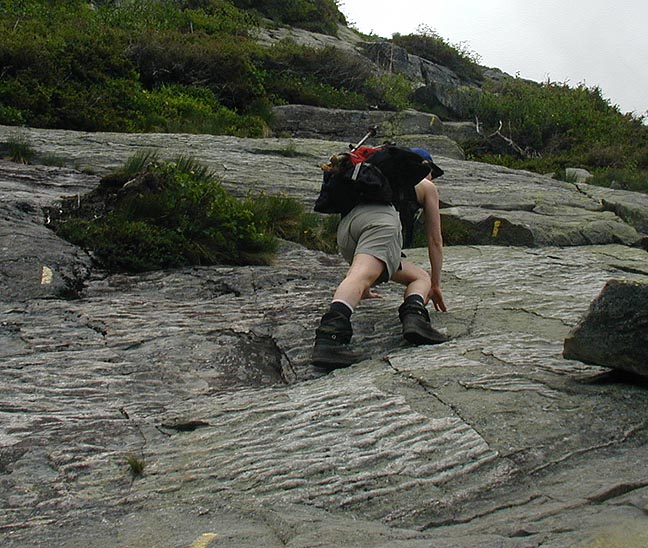
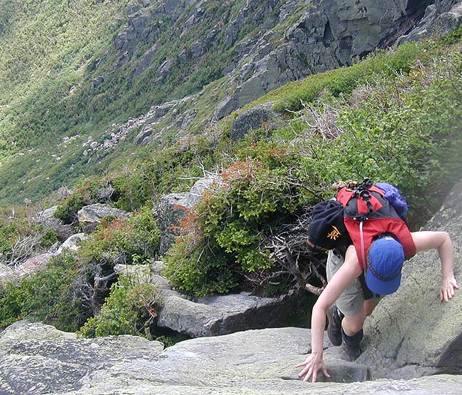
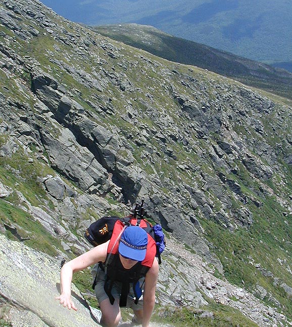
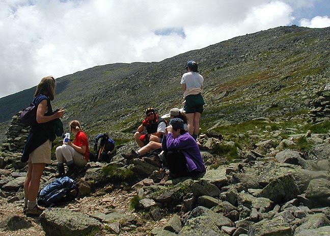
 We stopped there for rest, food, and water. Above us was the fun part of the hike, steep
slabs of rock with some cracks and handholds. The first move is definitely the crux move,
because you do get 20 or so feet up before you get your feet
back underneath you. It was
exhilarating but we made it up without too much gnashing of teeth. There are several more
sections of scrambling after that but nothing as bad as that first one. The trail climbs
very quickly, so the views across to Tuckerman and
base of the ravine are
below you for the entire trip. Eventually the terrain started
leveling off and we came
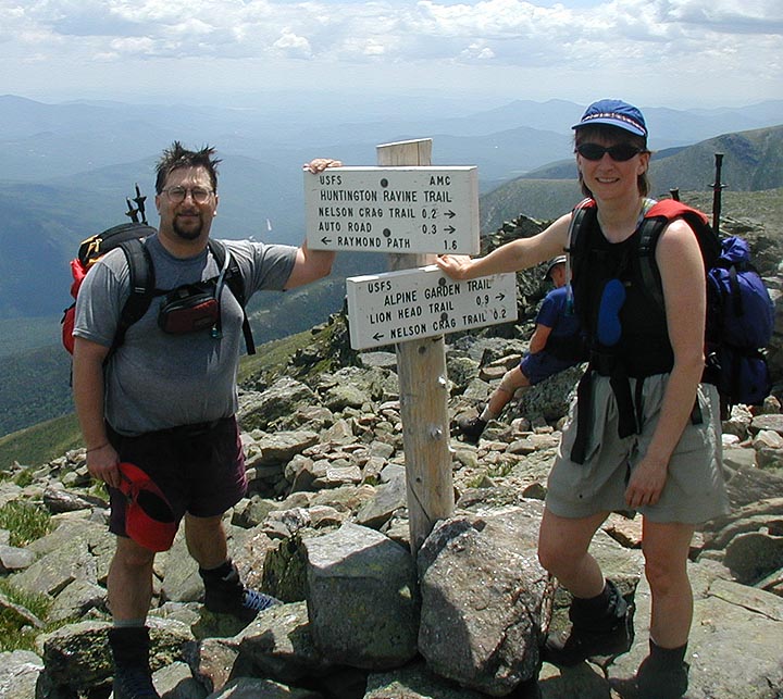
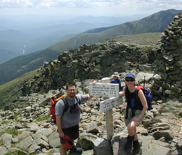
out to the intersection with the Alpine Garden trail. We'd made it up Huntington!
We stopped there for rest, food, and water. Above us was the fun part of the hike, steep
slabs of rock with some cracks and handholds. The first move is definitely the crux move,
because you do get 20 or so feet up before you get your feet
back underneath you. It was
exhilarating but we made it up without too much gnashing of teeth. There are several more
sections of scrambling after that but nothing as bad as that first one. The trail climbs
very quickly, so the views across to Tuckerman and
base of the ravine are
below you for the entire trip. Eventually the terrain started
leveling off and we came
out to the intersection with the Alpine Garden trail. We'd made it up Huntington!
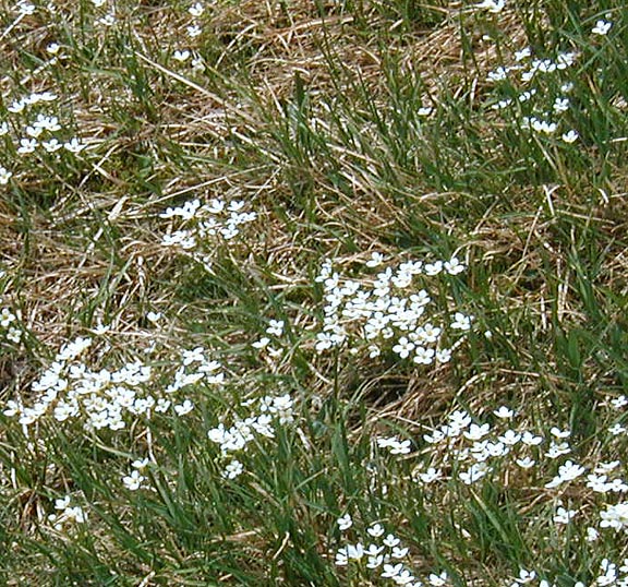
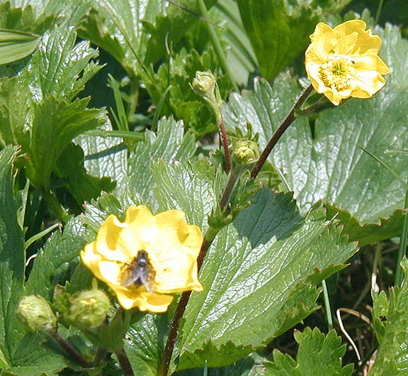
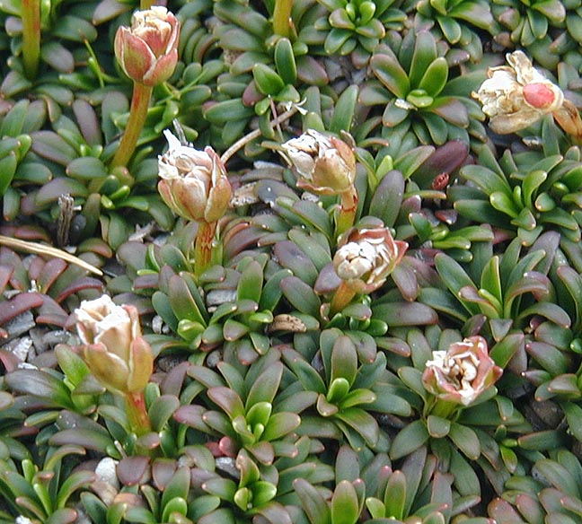
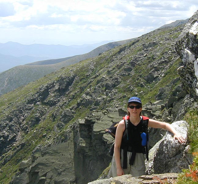
 We met a group of folks who'd hiked over from Lakes of the Clouds and they reported that the
flowers on Alpine Garden weren't as spectacular as they had hoped for. But hey, we were there
and we definitely were going to see for ourselves. We paused at the trail junction, taking some
photos and just relishing in the fact that we'd made it up. From here there was a possibility
that we'd just cross the Alpine Garden then descend, but I doubted we'd go for that. Once on the
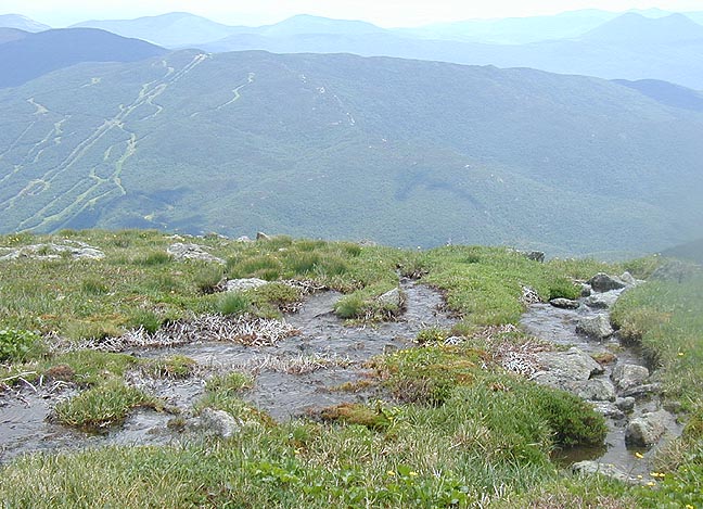
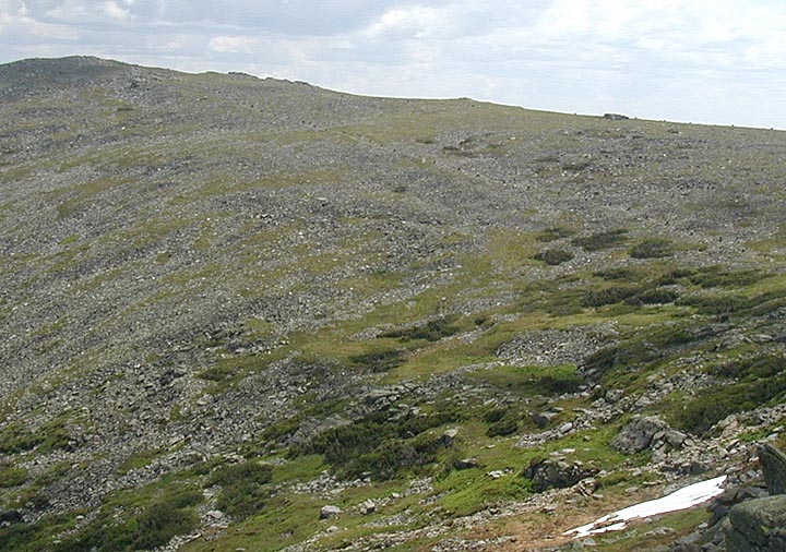
Alpine Garden trail it was a big difference, a nearly flat
trail after the steep climbing in Huntington. The flowers were indeed in bloom, but not quite
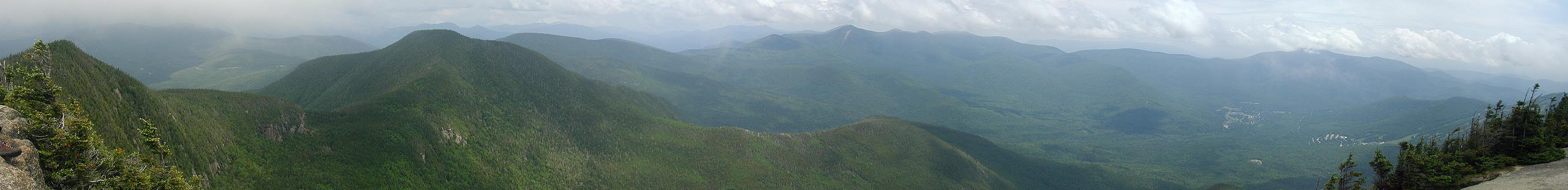
as spectacular as we had hoped, funny that. But the hike across is wonderful (movie), a floating on air
sort of feeling. There were of course lots more people once up top, including folks who'd driven
the summit and were taking a loop around. We reached the junction with the Lion Head trail and ate
our lunch. It was around 1:00 and we knew we still had a bit of work to do.
We met a group of folks who'd hiked over from Lakes of the Clouds and they reported that the
flowers on Alpine Garden weren't as spectacular as they had hoped for. But hey, we were there
and we definitely were going to see for ourselves. We paused at the trail junction, taking some
photos and just relishing in the fact that we'd made it up. From here there was a possibility
that we'd just cross the Alpine Garden then descend, but I doubted we'd go for that. Once on the
Alpine Garden trail it was a big difference, a nearly flat
trail after the steep climbing in Huntington. The flowers were indeed in bloom, but not quite
as spectacular as we had hoped, funny that. But the hike across is wonderful (movie), a floating on air
sort of feeling. There were of course lots more people once up top, including folks who'd driven
the summit and were taking a loop around. We reached the junction with the Lion Head trail and ate
our lunch. It was around 1:00 and we knew we still had a bit of work to do.


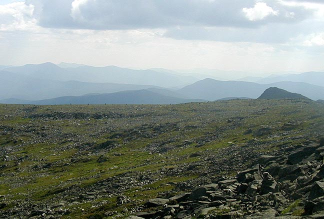
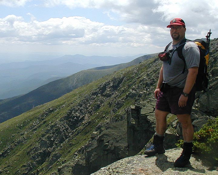
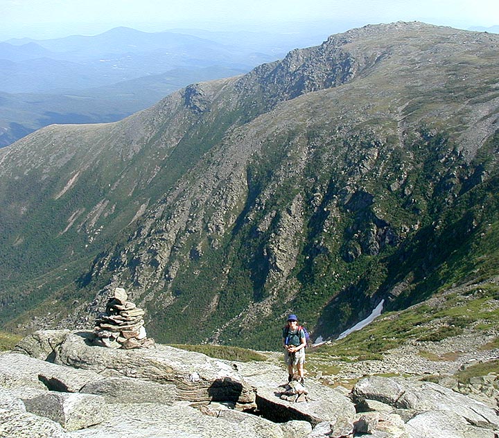
 Once above Tuckerman Ravine, the trail is all rocks, but the view
is worth it. There were lots of people climbing, so we had
to occasionally wait in line for difficult sections, but we were already in fast hiking mode so the
summit got closer and closer. We passed the Boy Scouts that we'd seen way down low, still chugging
along but not moving too fast. I wonder where they ended up that night, and when they got in? Soon
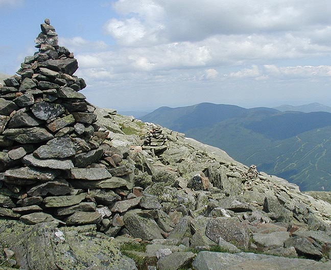
we could hear the cars and the train, plus the buzz from people up top. We crested to the road and
parking lot, climbed the steps and wandered onto the summit itself, then spent some time
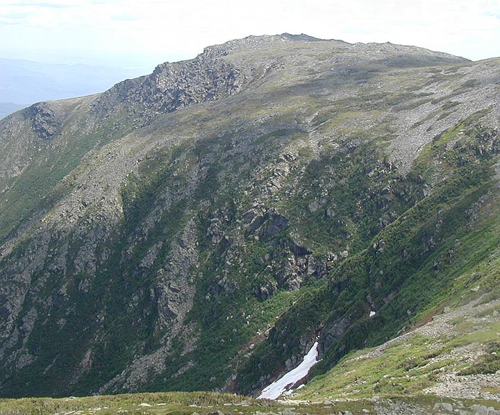
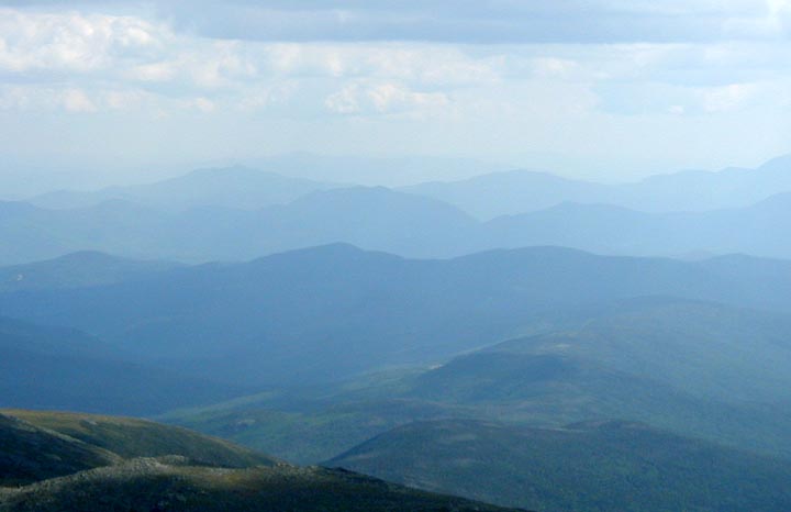
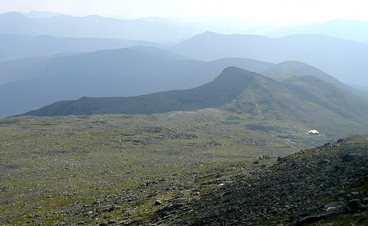
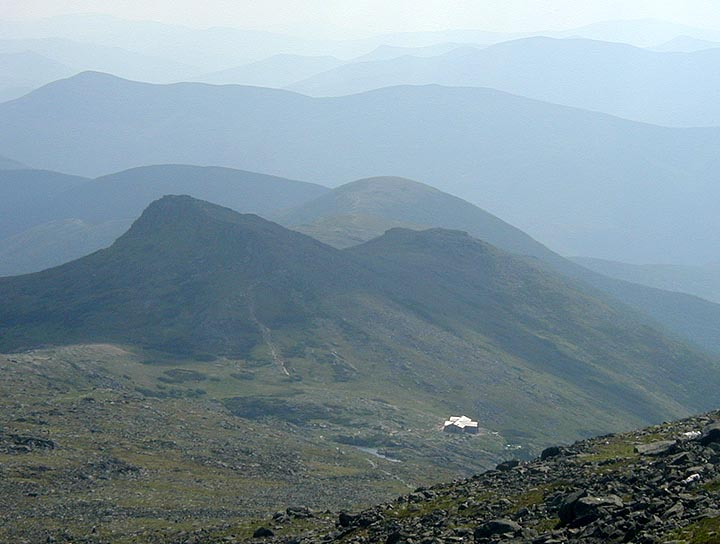
on viewing platform. The view towards the Northern Presidentials
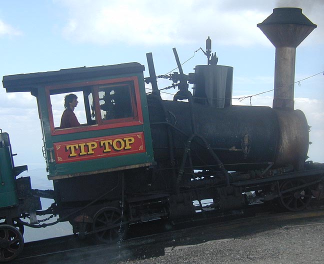
was spectacular as expected. We went into the Sherm Adams building to use the bathrooms and
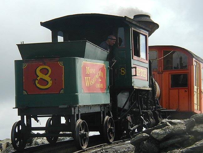
get some Gatorade. After some well deserved rest, I wandered out to where the Cog RR comes up and
took some photos and video of the trains reaching the summit. Although I really don't enjoy hearing
or smelling the Cog, the engineer in me is still amazed. We spent about an hour up there, filled up
our water bottles, took a little Ibuprofin, and headed back down the Lion Head trail.
Once above Tuckerman Ravine, the trail is all rocks, but the view
is worth it. There were lots of people climbing, so we had
to occasionally wait in line for difficult sections, but we were already in fast hiking mode so the
summit got closer and closer. We passed the Boy Scouts that we'd seen way down low, still chugging
along but not moving too fast. I wonder where they ended up that night, and when they got in? Soon
we could hear the cars and the train, plus the buzz from people up top. We crested to the road and
parking lot, climbed the steps and wandered onto the summit itself, then spent some time
on viewing platform. The view towards the Northern Presidentials
was spectacular as expected. We went into the Sherm Adams building to use the bathrooms and
get some Gatorade. After some well deserved rest, I wandered out to where the Cog RR comes up and
took some photos and video of the trains reaching the summit. Although I really don't enjoy hearing
or smelling the Cog, the engineer in me is still amazed. We spent about an hour up there, filled up
our water bottles, took a little Ibuprofin, and headed back down the Lion Head trail.


 The trip down, as usual, was less exciting than the trip up. We were taking our time up top, no
need to twist an ankle on the rough rocks near the summit. Eventually we made to past the
closed
Tuckerman Ravine trail, over the short scrambles, and back to the easier terrain above Lion Head.
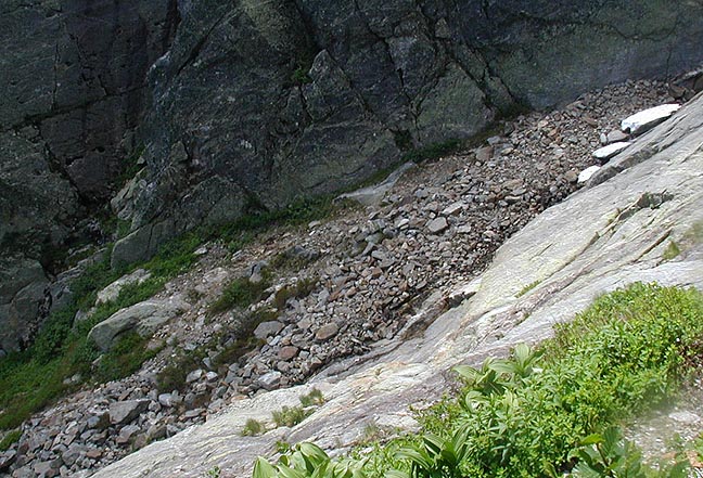
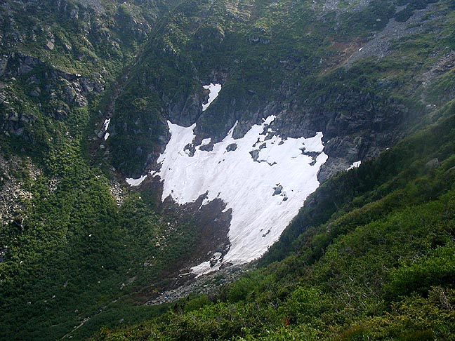
Tuckerman Ravine still had a big patch of snow,
where someone had been killed skiing just a few
weeks earlier. The rocks below Lion Head itself were begining to make our legs ache, and we finally
re-entered the trees after 5 hours above treeline. The section of Lion Head from treeline to
Hermit Lake, with its ladders and scrambles, is draining.
Finally, we hit the shelters and the Tuckerman Ravine
trail and just put it on cruise control. The trail seems to go on forever, just like hiking out
the Wilderness Trail at the end of a long day. We made it out to Pinkham around 6:00, nearly nine
full hours for the hike. We took advantage of the showers in Porky Gultch, which made the drive
home much more enjoyable.
The trip down, as usual, was less exciting than the trip up. We were taking our time up top, no
need to twist an ankle on the rough rocks near the summit. Eventually we made to past the
closed
Tuckerman Ravine trail, over the short scrambles, and back to the easier terrain above Lion Head.
Tuckerman Ravine still had a big patch of snow,
where someone had been killed skiing just a few
weeks earlier. The rocks below Lion Head itself were begining to make our legs ache, and we finally
re-entered the trees after 5 hours above treeline. The section of Lion Head from treeline to
Hermit Lake, with its ladders and scrambles, is draining.
Finally, we hit the shelters and the Tuckerman Ravine
trail and just put it on cruise control. The trail seems to go on forever, just like hiking out
the Wilderness Trail at the end of a long day. We made it out to Pinkham around 6:00, nearly nine
full hours for the hike. We took advantage of the showers in Porky Gultch, which made the drive
home much more enjoyable.